
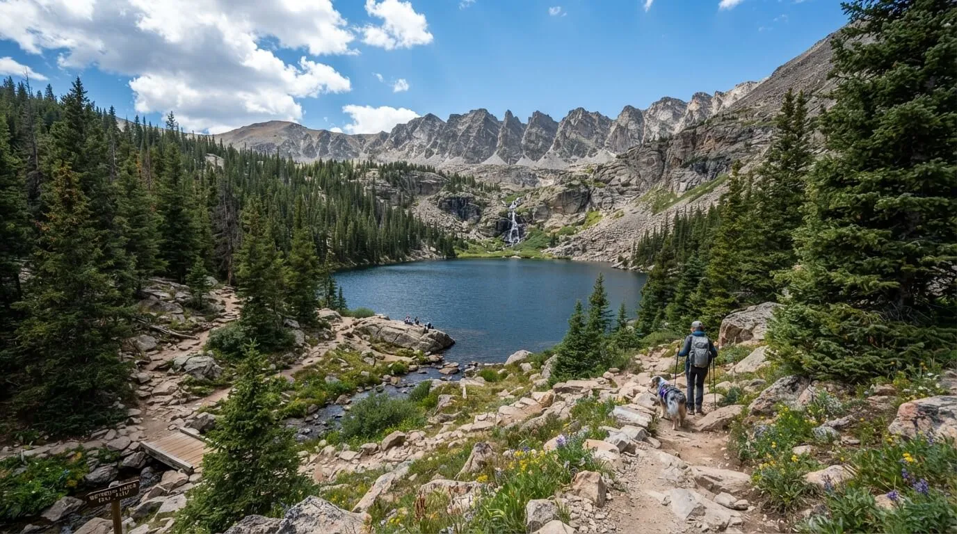
Hiking the Waterdog Lakes Trail near Salida is one of the easiest ways to reach a real alpine lake in Chaffee County. The trail starts right off US 50 near Monarch Pass, so you are on the path soon after leaving town. Known as trail #1417, this moderate day hike climbs steadily through pine forest, past a rushing creek, to a quiet lake below the Continental Divide.
It is short but steep and rocky. Most sources list the distance at about 2.6 to 3.3 miles round trip, with roughly 1,050 feet of climbing.
This guide covers where to park, when to go, how to reach the upper lakes, and what to pack. If you love Salida hiking with big views and a short drive, this Waterdog Lakes hike is a great pick.
Waterdog Lakes Trail at a Glance
Here are the quick facts before you lace up your boots. The Waterdog Lakes Trail is a moderate hike in San Isabel National Forest. Expect a round trip of about 2.6 to 3.3 miles, though some maps list more if you visit the upper lakes. You will climb roughly 1,050 feet and reach about 11,390 feet at the first lake. Most people need two to three hours, plus time to relax by the water. The best season runs from late spring to early fall. Leashed dogs are welcome. This hike suits fit beginners, families with active kids, and anyone who wants an easy-to-reach alpine lake. If you dislike steep, rocky paths, you may find it tiring. Always check the latest permit and trail conditions first.
Where Is the Waterdog Lakes Trail?
The Waterdog Lakes Trail sits just off US 50, on the east side of Monarch Pass. It lies inside San Isabel National Forest, and its official number is trail #1417. From Salida, the drive takes roughly 30 minutes. You head west through Poncha Springs and climb toward the pass. From Buena Vista, plan on about an hour, since you drive south first. Check your phone map before you leave town, because cell service fades in the mountains. The trailhead is about 15 miles up US 50 from Poncha Springs. It is a short, scenic drive and a great pick if you only have half a day. Start early so you have plenty of daylight for the climb and the drive back.
Parking and Finding the Trailhead
Waterdog Lakes trailhead parking is simple, but the trailhead is easy to miss. Look for a few gravel pullouts on the left side of US 50 as you drive west. The trail sign is across the highway, and it is hard to see at speed. If you reach the Monarch Park Campground road, you have gone too far. Cross the highway with care. Traffic moves fast, so stop, look both ways, and cross together. The lot is small and can fill up on weekends, so arrive early, ideally in the morning. There are no restrooms or water at the trailhead. Use your phone to drop a GPS pin at the car, which helps on the way down. Never park on the road itself, and leave nothing valuable in sight.
Do You Need a Permit or Pass?
This is one detail to double-check before you go. One trail listing says a parking permit from the U.S. Forest Service is required, but other guides do not mention one. Rules can change, so call the Salida Ranger District or check the Forest Service website. If you plan to fish in the lakes, you also need a Colorado fishing license. You can buy one online ahead of time. Groups should keep to 12 people or fewer, which is the limit listed by one source. It is also smart to carry a CORSAR card, which helps cover the cost of a rescue in Colorado. Bring a printed or saved copy of any pass you buy, since you may not have cell service.
Mile-by-Mile Trail Description
The trail starts steep, with tight switchbacks through pine forest beside a loud creek. At about 0.3 miles, a new trail joins an old drainage. Turn right and follow the wider path. Soon you walk under power lines, and the route is easy to follow. Around 0.9 and 1.0 miles, you cross two small creeks, which may be dry late in the season. At 1.2 miles, the trees open into a meadow, and the views begin to open up. The first lake appears near 1.3 miles, at about 11,390 feet. Watch for loose rock on the way back down. Take your time; the climb is steady. Save a GPX file to your phone before you start, since the path can feel confusing in spots.
Reaching the Upper Lakes
Many hikers stop at the first lake, but there are more lakes above it. Some guides count three, and others count four, including a small lake that only fills after snowmelt. There is no official trail to the upper lakes, so use a downloaded map. One common route passes the first lake on the north side, then follows the east shore of the second lake. Another guide says to go south around the first lake and head west. Either way, the path is faint and can be hard to find. Step on rock when you can, to protect the soil and plants. If clouds build or you feel unsure, turn around. The first lake is a lovely goal on its own.
Best Time to Hike Waterdog Lakes
Most hikers visit from June through September, and some start as early as mid-May when snow allows. Snow can linger near the lake into early summer, so expect wet, slushy spots in June. July and August bring wildflowers, warm days, and the best chance for a dry trail. Fall is quiet and colorful, but nights get cold, and early snow is possible by October. Aim to start in the morning. Storms often build in the afternoon in the high country, and you want to be off the upper trail by then. Check the weather forecast and recent trail reports the day before. Mountain weather can turn fast, even in July. Winter hikes are possible too, but they need snow gear and extra care.
Trail Conditions, Weather and Safety
Safety comes first at this height. The trail tops out near 11,400 feet, so altitude can make you tired or give you a headache. Drink water often, walk slowly, and turn back if you feel sick. Thunderstorms are the biggest risk in summer. If you hear thunder, head down right away and stay off open ridges. Pack rain gear, even on sunny mornings. Cell service is weak or missing, so download a map before you leave. Tell a friend your plan and expected return time. Carry the 10 essentials, including a light, first-aid kit, and extra food. Finally, check trail conditions on the Forest Service page or a trail app before you drive up. A CORSAR card adds extra peace of mind.
What to Pack for Waterdog Lakes
You do not need much, but the right gear helps. Wear sturdy hiking boots or trail shoes with good grip, since the path is rocky. Dress in layers, because the lake can be colder than the trailhead. Pack a rain jacket, a warm hat, and light gloves, even in summer. Sunscreen and sunglasses matter at high altitude. Bring two liters of water, plus snacks like nuts, fruit, or a sandwich for a lakeside picnic. Add a downloaded map, a small first-aid kit, and a headlamp in case you finish late. Trekking poles help on loose rock. If you bring a dog, pack extra water and a bowl. A small trash bag lets you carry out everything you brought. Keep your pack light.
Hiking Waterdog Lakes with Dogs and Kids
Yes, dogs are allowed on the trail, but they must stay on a leash. The biggest worry is the busy highway, so clip the leash on before you cross. Some creek crossings can be tricky for small dogs. Bring extra water, since dogs get thirsty on a steep climb. Kids can do this hike if they are used to walking. The steep trail and high altitude may slow them down, so plan extra breaks and lots of snacks. Hold hands at the highway crossing, and keep little ones close near the water. Turn around early if anyone gets tired. The first lake is a perfect goal for kids, with rocks to explore and a good snack spot. Always carry out dog waste.
Fishing, Wildlife and the Tiger Salamander
The lakes are named for the tiger salamander, also called a waterdog. These small, speckled animals live in some Colorado mountain lakes. They hide in burrows and are mostly active at night, so you may never see one. If you do, please do not touch or catch it. Hikers also report brook trout in the clear water. You need a Colorado fishing license, and you should check the current fishing rules first. Keep an eye out for birds and other wildlife, and give animals plenty of space. Follow Leave No Trace habits: pack out all trash, stay on the path, and keep your voice low. A quiet visit helps the lakes stay wild for the next hiker. Never feed wildlife, even small animals.
Winter Access: Snowshoeing and Backcountry Skiing
The Waterdog Lakes Trail is not just a summer hike. In winter, people use it for snowshoeing, and some skin up on skis or splitboards. Winter trips are harder, though. The trail is steep, the days are short, and snow can hide the path. You need snow gear, warm layers, and good navigation skills. This area can have avalanche terrain, so check the avalanche forecast from the Colorado Avalanche Information Center before you go. Carry a beacon, shovel, and probe if you travel in steep, snowy slopes, and know how to use them. Never go alone. If you are new to winter travel, take a class or join a guided trip first. Also check road and parking conditions, since snow can limit space at the pullouts.
Where to Stay and Eat Nearby
Many hikers make this a half-day trip from town. Salida has plenty of hotels, cabins, and cozy cafes, so it is an easy base. Poncha Springs is a handy stop on the way. If you want to camp, Monarch Park Campground is close to the trailhead. In summer, some weekends have minimum-night rules, so check the current policy and reserve early. There is no camping at the trailhead itself. After your hike, head back to Salida for burgers, pizza, or a cold drink along the river. Many places have patios that suit tired legs. A hot lunch after a mountain hike tastes great. If you plan to stay overnight in town, book early for summer weekends, since Salida gets busy in peak season.
Other Hikes Near Monarch Pass and Salida
If you love this trail, you have plenty of nearby options. Hunt Lake is a short hike below the Continental Divide, and Boss Lake is a small reservoir that is great for a picnic. Grass Lake is another lake worth a look near the pass. For a bigger challenge, try the Monarch Crest Trail, known for long views along the Divide, though many people bike it. Browns Creek Falls is a good choice if you want a waterfall instead of a lake. In town, the S trail and Tenderfoot Hill make easy, quick outings. Each one offers a different view of Chaffee County. Pair two short hikes over a long weekend, and you will see a lot of Salida hiking at its best.
Waterdog Lakes Trail FAQ
How long is the Waterdog Lakes hike?
About 2.6 to 3.3 miles round trip, or 2 to 3 hours.
Is it hard?
It is moderate, but steep and rocky.
Is it dog friendly?
Yes, on a leash.
Do I need a permit?
One listing mentions a parking permit, so check with the Forest Service.
Can I camp at the lakes?
Rules can change, so check with the Forest Service first. There is no camping at the trailhead.
Can I bike it?
It is bike-legal, but it is very steep and rocky.
What is the best month?
July and August usually offer the driest trail.
Is it crowded?
Weekends can be busy, so start early. Weekday mornings are usually quieter.